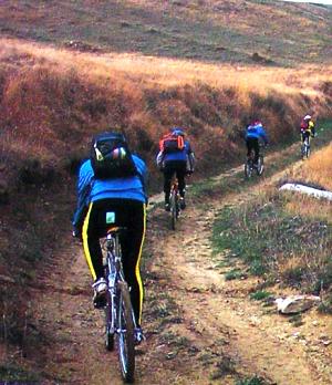
Abruzo Busil Sul Tirino to Forca Di Penne!
 Passing
a cemetery that lies l.5 km from the starting point in Bussi-on-hrino {altitude
300 ml. the mountain biker con— tinues uphill along the dirt road as lar as a
fork l2.? km. al— titude 490 ml. goes on straight until reaching a small house
built of cement blocks and a drinking trough {8 krn, altitude 850 ml, then goes
up a climbing stretch of the route that has views over the valley of the Urine
River, then on a downhill section that follows and that passes directly at the
bese of the rocky slope ol lvlontagna di lloccataglrata. The road then climbs
somewhat before coming to a bridle path ahouta hun— dred metres along; this mule
track goes down to the valley underneath. There is a bend to the right at this
point. The cyclist foliows the bend in the road. which is uphill fora few metres.
then goes downhill, passing another fork in the road. with then a straight,
downhill stretch. This leads to a small house lt0.5 krn, altitude 650 ml. A
section of paved road starts here and brings the mountain biker to the road for
Pescosansonesco [13 km, altitude 550 ml a few hundred me- tres further along. A
respite at this point before tackling the most demanding stage of the ride.
which starts out from the villages old sec- tion and follows the signs for Fonte
Fredda. A short initial stretch climbs steeply on a roadbed initially of asphalt
that then turns rocky The ride is downhill right from where this part ofthe
route ends as far as a wider dirt road ll5.6- km. altitude 750 ml which the
cyclist turns into, going to the right.
The ride becomes somewhat testing again during a series of climbing sections spaced out by level terrain in between each, This stretch leads to Colle Flotondo Creep {18.1 km, al- titude B10 ml. From here the ride is down, then up as lar as Capo d'Acqua (19.5 km, altitude 995 m}. At a fork inthe road near a spring the mountain biker begins a stretch of about 1 km of downhill cycling to the point where
a small road - near a house and the road sign "l0 `F." - appears on the left. The route follows this road for another 500 rn to a hairpin bend. Another dirt road on the left at this point goes into the woods and brings the mountain biker in fairly quick order to Foroa di Penne l22 krn, al- titude 900 ml. The return route starts at a fork in the road where the cyclist turns and heads inthe direction of Olena and Villa Santa Lucia, riding downhill for about 3 km to Delfino. At the point where this country locality begins, two unpaved roads branch off left in sequence, The moun— tain hiker takes the first of these, cycling downhill to Capo o"Acqua and keeping a sharp eye on this long cart tracks roadbed in doing so. From Capo d‘Acqua [30 km,
altitude 340 ml the route brings the cyclist to the point where a fork branches off to Capstrano on the road for [Aquila. From Capestrano the mountain biker goes left toward Bus- si, taking the unpaved road off to the right which is 5UO m further along, This road follows the truly lovely banks of the lirino {see the next itinerary} all the way back to Bussi alter a total 42-km ride from start to finish.
Could not open input file: /home/exoticit/public_html/carousel.php

